It’s Earth Day: Show Our Public Lands Some Love
Did you know the federal government manages approximately 640 million acres of public land? That translates to about 28% of the nation’s 2.27 billion acres! Multiple government agencies are charged with working together to protect the wild landscapes, the wildlife that live there and America’s outdoor heritage. The agencies involved include:
- Bureau of Land Management
- U.S. Fish and Wildlife Service
- National Park Service (under the Department of the Interior)
- U.S. Forest Service (under the Department of Agriculture)
This Earth Day, get to know a few of these special places and the wildlife that call them home.
Tongass National Forest, Alaska

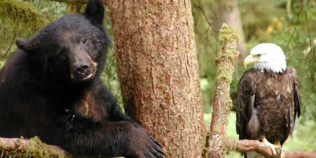
Bear and Eagle, Tongass National Forest.
The largest national forest, Tongass covers nearly 17 million acres across southeast Alaska surrounding the famous Inside Passage. The landscape, stretching 500 miles from north to south, encompasses thousands of islands, fjords and glaciers and lush valleys that back into the Coast Mountains, as well as an old-growth forest full of cedar, spruce, and hemlock trees. The landscape was first protected as the Alexander Archipelago Forest Reserve by President Theodore Roosevelt in a 1902 presidential proclamation. Three additional proclamations from Roosevelt and one from President Calvin Coolidge outlined the forest as we know it today.
The expansive landscape is home to abundant outdoor recreation activities and incredible chances to observe wildlife and wild habitats. In areas like the Fish Creek Bear viewing area and Anan Wildlife Observatory Site, visitors can see bald eagles, grizzly bears, black bears, Sitka black-tailed deer, and other species of wild Alaska. If wildlife enthusiasts look closely at the streams and coastal waters throughout the forest, they can find all five wild Pacific salmon species: King (Chinook), sockeye, coho, pink, and chum!
Yellowstone National Park, which straddles Wyoming, Montana and Idaho
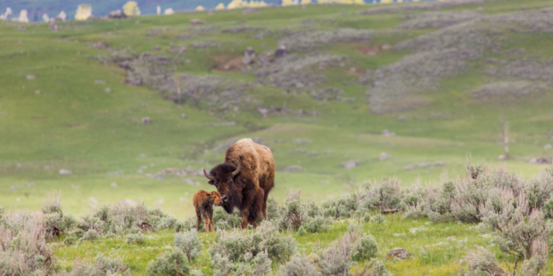
Newborn bison with mother at Lamar Valley at Yellowstone National Park. Neal Herbert, YNP.
Indigenous peoples hunted and lived in what is now Yellowstone National Park for more than 11,000 years, as shown by archeological sites, trails, and oral histories. European Americans began exploring the landscape in the early 1800s before the area was established as the world’s first national park by the Yellowstone National Park Protection Act in 1872. While the U.S. Army managed Yellowstone during the park’s early years, the National Park Service began managing the landscape when that agency was created in 1916.
In 1902, there was only two dozen bison left in Yellowstone. Over the next 100 plus years, park officials, conservationists, and tribes worked to bring that iconic Western species back from the brink of extinction and helped launch one of our country’s greatest conservation undertakings, one that is ongoing. The bison population that now roams the park – and occasionally beyond its boundaries – increases by 10 to 17% every year and has lent urgency to finding other places for wild, genetically pure bison to live. National Wildlife Federation is working with tribes and other partners to get more bison, our national mammal, on tribal and other public lands to restore a key species missing from much of our wild lands.
Cascade-Siskiyou National Monument, Oregon and Washington
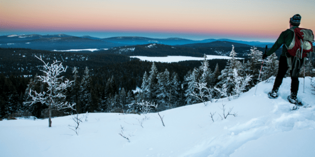
Cascade-Siskiyou National Monument is a Pacific Northwest outdoor recreation haven. Bob Wick, BLM.
Since the Antiquities Act gave the president the power to establish national monuments in 1906, presidents have used their authority to protect large swaths of environmentally-sensitive public lands. Millions of acres are currently preserved in more than 80 national monuments. As the administration focuses on achieving “energy dominance” by approving drilling and mining on public lands, the habitat protections that sustain biodiversity on national monuments are at risk of being rolled back or scrapped entirely.
The Cascade-Siskiyou National Monument, which lies at the crossroads of the Cascade, Klamath, and Siskiyou mountain ranges in Oregon, is among the most biodiverse region in North America, according to the Siskiyou Institute. This remarkable area contains more different species of coniferous trees than any region of North America. More than about 135 species of butterflies, according to the Bureau of Land Management, depend on the national monument’s diverse flora to survive. Different species of skipper, metalmark, brushfoot, swallowtail, Gossamer wing, and whites and sulphurs butterflies can be found floating between the flowers of the Cascade-Siskiyou range.
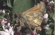
A Lindsey’s Skipper. Fred Ramsey.
One notable species is Lindsey’s Skipper. Visitors can identify the skipper by its bright yellow wings outlined by a narrow, dark border, pale veins and irregular pale spots. Throughout the Cascade-Siskiyou National Monument, Lindsey’s Skipper can be seen in the grassy foothills, chaparral and oak woodlands of the Scotch Creek and Oregon Gulch Research Natural Areas, around Pilot Rock and Porcupine Creek, and along Soda Mountain Road.
Pelican Island National Wildlife Refuge, Florida
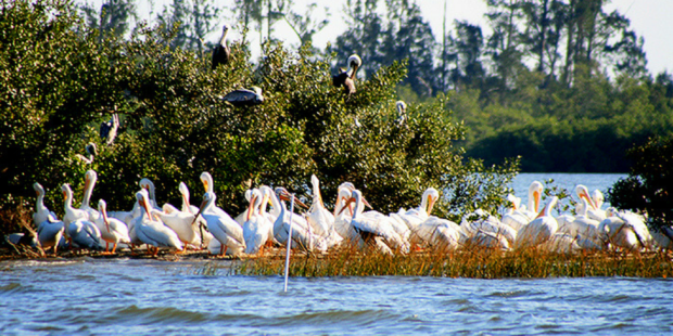
Brown and white pelicans resting on Pelican Island National Wildlife Refuge. USFWS.
Brown pelicans’ natural affinity for a 5.5-acre island helped spur modern conservation efforts and the creation of the national wildlife refuge system. In the 1800s, Floridians noticed how the island functioned as a natural rookery for as many as 100,000 pelicans and dubbed the area “Pelican Island.” Pelican Island in the Indian River Lagoon was declared the first federal bird reservation President Theodore Roosevelt in 1903, the forerunner to the National Wildlife Refuge System, now managed by the U.S. Fish and Wildlife Service.

An aerial view of Pelican Island. USFWS.
When the reservation was first established, wardens focused on keeping egg collectors and market hunter from decimating the pelican population. In 1963, Pelican Island National Wildlife Refuge was designated as a National Historic Landmark due to its status as the first federal area specifically designated to protect wildlife.
Over 100 years later, pelicans still return to the island – though fewer than 100 nesting pairs return in the spring. Pelicans aren’t the island’s only inhabitants. More than 140 bird species use the island to roost, feed or rest. At least 16 different species nest on Pelican Island proper. The Pelican Island colony today remains as one of the most consistently active rookeries in the State of Florida.
Boundary Waters Canoe Area Wilderness, Minnesota
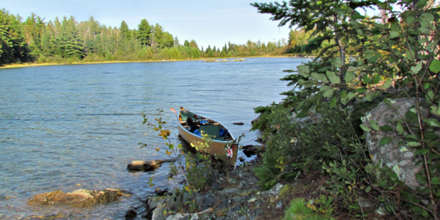
Boundary Waters. Marilyn Kircus.
Nestled in the northern third of Minnesota’s Superior National Forest, the Boundary Waters Canoe Area Wilderness hasn’t changed much since the glaciers melted. Massive glaciers gouged out rocks, cliffs and crags, islands, and more than 1,000 lakes and streams are now surrounded by forest. With more than 1,500 miles of canoe routes, 2,000-plus campsites, and 12 hiking trails, the Boundary Waters Canoe Area is an ideal escape for sportsmen, athletes, and nature enthusiasts to embrace solitude and nature.
What we know as the Boundary Waters Canoe Area Wilderness was assembled through a series of actions throughout the 20th century. Minnesota’s Forest Commissioner Christopher C. Andrews first persuaded the state to protect 500,000 acres of land near the modern wilderness area in 1902. In 1926, an area that would become the nucleus of the Boundary Waters Canoe Area was set aside to preserve its primitive characters before the area was officially named in 1958. The Wilderness Act designated Boundary Waters Canoe Area Wilderness as a unit of the National Wilderness Preservation System. Since the landscape remains largely wild, visitors can canoe and camp in the spirit of voyagers that explored the Boundary Waters landscape 200 years ago.
Wildlife populations thrive throughout the rugged and wild area. Black bear, moose, gray wolves, Canada lynx, bald eagles, and loons can be found across the wilderness. The Boundary Waters falls within the range of the largest population of wolves in the continental U.S., while the area’s fishing remains among the best in the state. The lakes and streams are renowned fisheries for brook, brown, rainbow and lake trout, walleye, northern pike, and both large- and smallmouth bass.
Katahdin Woods and Waters National Monument, Maine
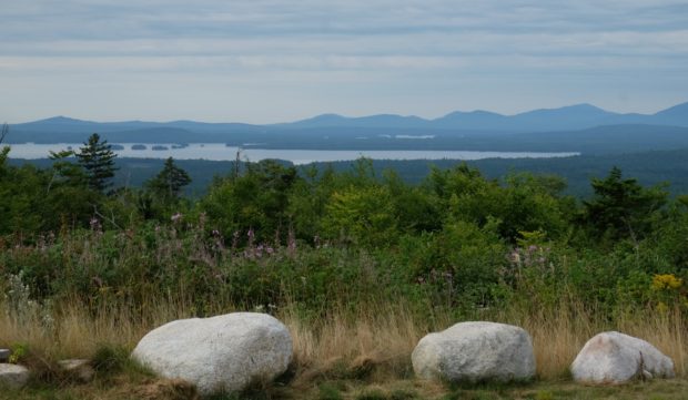
Katahdin Woods and Waters National Monument protects vital habitat for northeast wildlife species like moose, loon, and Canada lynx.
Some 150 years ago the woods and waters of northern Maine captivated naturalist and philosopher Henry David Thoreau. Today, this pristine place still offers a chance to get lost in the thick of dense forests, to rest on the bank of a river with morning fog still sitting low, and if you are lucky, patient and still – perhaps you will hear the bugle of a moose or the cry of the loon.
In 2003 Roxanne Quimby, co-founder of Burt’s Bees, began buying former timberland in northern Maine. In the end, Ms. Quimby purchased 87,500 acres of land, to donate to the American people in perpetuity. On August 24th, 2016 President Obama created the Katahdin Maine Woods and Waters National Monument, preserving this special place for future generations and safeguarding vital habitat for wildlife in northern Maine.
With a monument designation came vital habitat protections for moose in the Katahdin Maine Woods and Waters and some welcome good news for a species at risk like the Canada lynx.
Known as the “gray ghost of the north” the Canada lynx has slowly disappeared from the contiguous United States. The animal is listed as “threatened” by US Fish and Wildlife Service, with confirmation of lynx populations in only four states, one of which is Maine. Habitat destruction and fragmentation are the greatest threats to the cat’s survival, making the protections provided by this national monument vitally important for this elusive cat.
In the spirit of Earth Day, share this blog on Twitter and spread the public lands love!
Share The Love for Public Lands!
Source: Public Lands
